
1952 Map of Saint Michael A-1
USGS Topo · Published 1958About this map
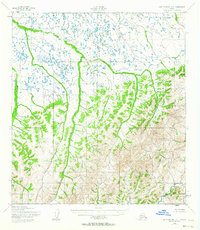
Kogok River and its intricate drainage system dominate this mid-century sub-arctic landscape, where riverine systems carve through terrain characterized by significant elevation changes. This 1952 survey shows the unpopulated wilderness of western Alaska as it was documented by the Army Map Service shortly after the war. The map highlights the headwaters and winding courses of the Pikmiktalik River, Andreafsky River, and a portion of the Unalakleet River at the northeastern corner. The topographic detail captured by aerial photography in 1951 illustrates a transition from the lower, lake-dotted tundra in the northwest to the more significant mountain ridges in the southeast, providing a detailed anatomical view of these Alaskan watersheds before any modern infrastructure development.
Find a feature on this map
4 named features on this map. Tap any name to fly to it.
Don’t see what you’re looking for? This feature index may not catch every label — zoom into the map to look around manually.
Map Details
Editions of this 1952 Saint Michael A-1 Map
2 editions found
Other maps of this area

1951 · Unalakleet
USGS Topo · 1:250,000

1951 · St Michael
USGS Topo · 1:250,000

1951 · Holy Cross
USGS Topo · 1:250,000

1952 · Kwiguk
USGS Topo · 1:250,000

1952 · Kwiguk D-1
USGS Topo · 1:63,360
1952 · Saint Michael B-2
USGS Topo · 1:63,360

1952 · Saint Michael B-1
USGS Topo · 1:63,360

1952 · Kwiguk D-2
USGS Topo · 1:63,360

1952 · Saint Michael A-2
USGS Topo · 1:63,360

1952 · Unalakleet B-6
USGS Topo · 1:63,360