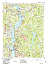
1984 Map of Uncasville
USGS Topo · Published 1984About this map
The Thames River serves as the central artery for this mid-1980s landscape, connecting the industrial and institutional hubs of New London and Norwich. Along the eastern bank, the massive U S Naval Reservation and its submarine base dominate the riverfront, while the Central Vermont railroad tracks follow the western shore through Uncasville. Further north, the expansive Norwich State Hospital complex sits across from the Fort Shantok State Park, highlighting the concentration of state and federal institutions in the corridor. Inland, the terrain shifts to a network of wooded hills and reservoirs, such as Ledyard Reservoir and Morgan Pond. The presence of sites like Hebrew Cem in Preston and the USCG Academy near the southern border illustrates the diverse cultural and educational infrastructure supporting the growing communities of Ledyard Center and Quaker Hill.
Find a feature on this map
145 named features on this map. Tap any name to fly to it.
Don’t see what you’re looking for? This feature index may not catch every label — zoom into the map to look around manually.
Map Details
Editions of this 1984 Uncasville Map
2 editions found
Other maps of this area

1889 · Stonington
USGS Topo · 1:62,500

1889 · Moosup
USGS Topo · 1:62,500

1892 · New London
USGS Topo · 1:62,500

1892 · Norwich
USGS Topo · 1:62,500

1893 · Moosup
USGS Topo · 1:62,500

1893 · Stonington
USGS Topo · 1:62,500

1893 · New London
USGS Topo · 1:62,500

1920 · Moosup
USGS Topo · 1:62,500

1921 · New London
USGS Topo · 1:62,500

1921 · Stonington
USGS Topo · 1:62,500