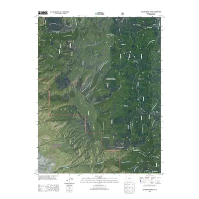
2013 Map of Uncompahgre Butte
USGS Topo · Published 2013About this map
Uncompahgre National Forest dominates this section of the Uncompahgre Plateau, where a network of forest roads and trails reveals the high-country navigation of the early 21st century. The map centers on Uncompahgre Butte, a prominent high point surrounded by canyons and drainages like Dark Canyon and Moon Canyon. Cultural evidence includes Colcord Camp, located near the intersection of the Upper Bench Trail 2625.0 and the Lower Bench Trail 2650.0. The landscape is a complex system of water and terrain, where Campbell Lake and Blue Creek Park provide rare open space among the deeper incisions of Blue Creek Canyon. These trails, including the Hells Half Acre Trail 2609.0, trace historical access routes through the Mesa County backcountry, serving as a record of land management and recreational geography.
Find a feature on this map
52 named features on this map. Tap any name to fly to it.
Don’t see what you’re looking for? This feature index may not catch every label — zoom into the map to look around manually.
Map Details
Editions of this 2013 Uncompahgre Butte Map
This is the sole edition of this map. No revisions or reprints were ever made.
Other maps of this area

1916 · Paradox Valley
USGS Topo · 1:125,000

1922 · Paradox Valley
USGS Topo · 1:125,000

1949 · Atkinson Creek
USGS Topo · 1:24,000

1949 · Red Canyon
USGS Topo · 1:24,000

1949 · Calamity Mesa
USGS Topo · 1:24,000

1950 · Calamity Mesa
USGS Topo · 1:24,000

1950 · Pine Mountain
USGS Topo · 1:24,000

1950 · Atkinson Creek
USGS Topo · 1:24,000
1950 · Red Canyon
USGS Topo · 1:24,000

1956 · Moab
USGS Topo · 1:250,000