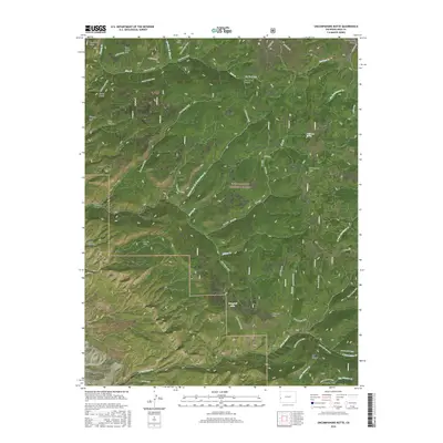
2016 Map of Uncompahgre Butte
USGS Topo · Published 2016About this map
The Uncompahgre Plateau dominates this high-elevation landscape within the Uncompahgre National Forest in western Colorado. The map reveals a complex network of drainages and dramatic elevation changes, notably through Blue Creek Canyon and Long Canyon. These landforms dictate the placement of modern access routes, which largely follow established paths like the Blue Creek Trail and Long Canyon Trail.
Find a feature on this map
53 named features on this map. Tap any name to fly to it.
Don’t see what you’re looking for? This feature index may not catch every label — zoom into the map to look around manually.
Map Details
Editions of this 2016 Uncompahgre Butte Map
This is the sole edition of this map. No revisions or reprints were ever made.
Other maps of this area

1916 · Paradox Valley
USGS Topo · 1:125,000

1922 · Paradox Valley
USGS Topo · 1:125,000

1949 · Atkinson Creek
USGS Topo · 1:24,000

1949 · Red Canyon
USGS Topo · 1:24,000

1949 · Calamity Mesa
USGS Topo · 1:24,000

1950 · Calamity Mesa
USGS Topo · 1:24,000

1950 · Pine Mountain
USGS Topo · 1:24,000

1950 · Atkinson Creek
USGS Topo · 1:24,000
1950 · Red Canyon
USGS Topo · 1:24,000

1956 · Moab
USGS Topo · 1:250,000