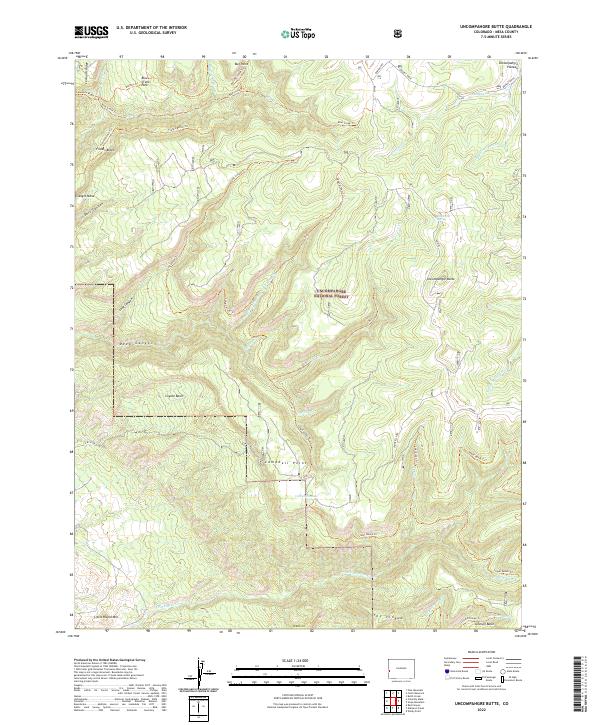
2022 Map of Uncompahgre Butte
USGS Topo · Published 2022About this map
Uncompahgre National Forest covers much of this high-elevation landscape in Mesa County, where the Uncompahgre Plateau drops into a series of complex canyons and benches. The terrain is characterized by massive promontories like Uncompahgre Butte and Campbell Point, separated by deep drainage systems including Deep Canyon and Dark Canyon. A network of historic routes, such as the Leonards Ridge Trl and Blue Creek Trl, traces the contours of the land, providing access across Franks Bench and Triangle Mesa.
Find a feature on this map
46 named features on this map. Tap any name to fly to it.
Don’t see what you’re looking for? This feature index may not catch every label — zoom into the map to look around manually.
Map Details
Editions of this 2022 Uncompahgre Butte Map
This is the sole edition of this map. No revisions or reprints were ever made.
Other maps of this area

1916 · Paradox Valley
USGS Topo · 1:125,000

1922 · Paradox Valley
USGS Topo · 1:125,000

1949 · Atkinson Creek
USGS Topo · 1:24,000

1949 · Red Canyon
USGS Topo · 1:24,000

1949 · Calamity Mesa
USGS Topo · 1:24,000

1950 · Calamity Mesa
USGS Topo · 1:24,000

1950 · Pine Mountain
USGS Topo · 1:24,000

1950 · Atkinson Creek
USGS Topo · 1:24,000
1950 · Red Canyon
USGS Topo · 1:24,000

1956 · Moab
USGS Topo · 1:250,000