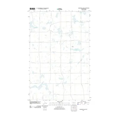
2011 Map of Underdahl Lake
USGS Topo · Published 2011About this map
Underdahl Lake sits at the heart of this prairie landscape in Ward County, characterized by a dense network of glacial wetlands and pothole lakes. The area is defined by a rigid section-line road grid, where routes like 107th Ave SW and 254th St SW navigate around dozens of unnamed water bodies. This 2011 survey reveals a quiet rural character where the primary landmark of local history is the Helland Cemetery, positioned just north of the namesake lake. The map illustrates the persistent agricultural and cemetery sites that serve as the anchors for this sparsely populated portion of the North Dakota plains, showing how transportation lines like 149th Ave SW adapt to the natural hydrology of the terrain.
Find a feature on this map
17 named features on this map. Tap any name to fly to it.
Don’t see what you’re looking for? This feature index may not catch every label — zoom into the map to look around manually.
Map Details
Editions of this 2011 Underdahl Lake Map
This is the sole edition of this map. No revisions or reprints were ever made.
Other maps of this area

1954 · Minot
USGS Topo · 1:250,000

1954 · McClusky
USGS Topo · 1:250,000

1958 · McClusky
USGS Topo · 1:250,000

1958 · Minot
USGS Topo · 1:250,000

1980 · Minot
USGS Topo · 1:100,000

1980 · Lake Vernon
USGS Topo · 1:24,000

1980 · Plaza SE
USGS Topo · 1:24,000

1980 · Makoti
USGS Topo · 1:24,000

1980 · Rice Lake NW
USGS Topo · 1:24,000
1980 · Underdahl Lake
USGS Topo · 1:24,000