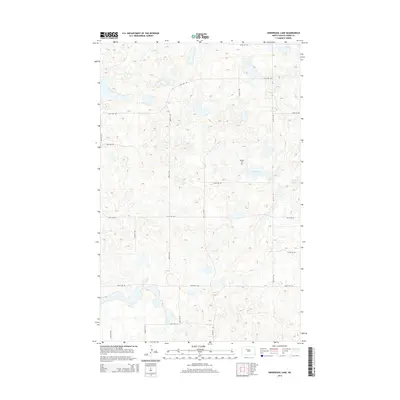
2014 Map of Underdahl Lake
USGS Topo · Published 2014About this map
Helland Cem stands as a solitary cultural marker in this section of Ward County, situated on the prairie north of Underdahl Lake. The landscape is defined by the complex, pothole-scattered topography characteristic of the region, where numerous small, unnamed depressions and wetlands are interspersed between low rises. To the east, Mellam Lake provides another significant hydrological feature in a territory otherwise dominated by a rigid grid of rural roads. This network, including 163rd Ave SW and 240th St SW, reveals a section-line development pattern typical of North Dakota’s agricultural reaches, where large-scale land divisions dictate the movement across the terrain. The proximity of the cemetery to the lake suggests the site's role as a historical focal point for the surrounding rural community.
Find a feature on this map
18 named features on this map. Tap any name to fly to it.
Don’t see what you’re looking for? This feature index may not catch every label — zoom into the map to look around manually.
Map Details
Editions of this 2014 Underdahl Lake Map
This is the sole edition of this map. No revisions or reprints were ever made.
Other maps of this area

1954 · Minot
USGS Topo · 1:250,000

1954 · McClusky
USGS Topo · 1:250,000

1958 · McClusky
USGS Topo · 1:250,000

1958 · Minot
USGS Topo · 1:250,000

1980 · Minot
USGS Topo · 1:100,000

1980 · Lake Vernon
USGS Topo · 1:24,000

1980 · Plaza SE
USGS Topo · 1:24,000

1980 · Makoti
USGS Topo · 1:24,000

1980 · Rice Lake NW
USGS Topo · 1:24,000
1980 · Underdahl Lake
USGS Topo · 1:24,000