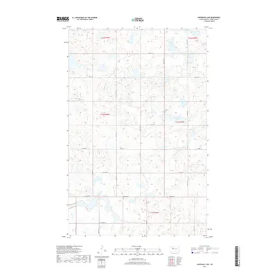
2017 Map of Underdahl Lake
USGS Topo · Published 2017About this map
Underdahl Lake and Mellam Lake anchor the water-spotted prairie of Ward County in this modern survey. The landscape is defined by the rigid grid of the Public Land Survey System, where section lines are traced by gravel and paved routes such as Co Hwy 18 and Co Hwy 20. This region maintains a traditional agricultural character, with scattered farmsteads and rural infrastructure organized within townships like t153n r86w and t153n r85w. For those researching local family ties, the Helland Cem stands as a significant genealogical landmark, situated along the section boundary near the lakes. The intricate network of wetlands and seasonal ponds shown throughout the quadrangle reflects the glacial history of the North Dakota plains.
Find a feature on this map
16 named features on this map. Tap any name to fly to it.
Don’t see what you’re looking for? This feature index may not catch every label — zoom into the map to look around manually.
Map Details
Editions of this 2017 Underdahl Lake Map
This is the sole edition of this map. No revisions or reprints were ever made.
Other maps of this area

1954 · Minot
USGS Topo · 1:250,000

1954 · McClusky
USGS Topo · 1:250,000

1958 · McClusky
USGS Topo · 1:250,000

1958 · Minot
USGS Topo · 1:250,000

1980 · Minot
USGS Topo · 1:100,000

1980 · Lake Vernon
USGS Topo · 1:24,000

1980 · Plaza SE
USGS Topo · 1:24,000

1980 · Makoti
USGS Topo · 1:24,000

1980 · Rice Lake NW
USGS Topo · 1:24,000
1980 · Underdahl Lake
USGS Topo · 1:24,000