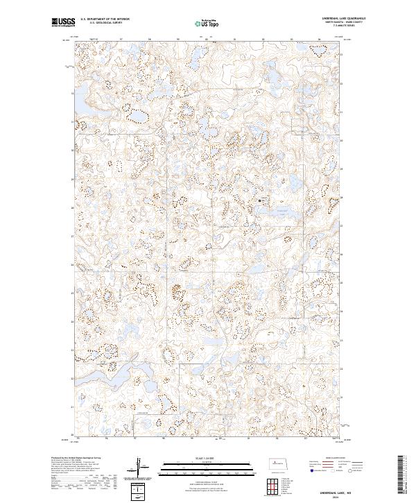
2024 Map of Underdahl Lake
USGS Topo · Published 2024About this map
The Ward County Waterfowl Production Area dominates the central and southern portions of this landscape, reflecting a region dedicated to conservation within the prairie pothole ecosystem. Numerous unnamed wetlands and small water bodies surround Underdahl Lake in the northeastern quadrant, illustrating the distinct glacial topography typical of the North Dakota plains. The area is structured by a rigorous grid of section lines and gravel roads, such as Co Hwy 18 and Co Hwy 20, which facilitate movement through the agricultural and protected lands. A single named cultural landmark, the Hiland Cem, sits near the eastern edge, serving as a quiet marker of the rural community's history and its deep-rooted connection to this specific terrain.
Find a feature on this map
22 named features on this map. Tap any name to fly to it.
Don’t see what you’re looking for? This feature index may not catch every label — zoom into the map to look around manually.
Map Details
Editions of this 2024 Underdahl Lake Map
This is the sole edition of this map. No revisions or reprints were ever made.
Other maps of this area

1954 · Minot
USGS Topo · 1:250,000

1954 · McClusky
USGS Topo · 1:250,000

1958 · McClusky
USGS Topo · 1:250,000

1958 · Minot
USGS Topo · 1:250,000

1980 · Minot
USGS Topo · 1:100,000

1980 · Lake Vernon
USGS Topo · 1:24,000

1980 · Plaza SE
USGS Topo · 1:24,000

1980 · Makoti
USGS Topo · 1:24,000

1980 · Rice Lake NW
USGS Topo · 1:24,000
1980 · Underdahl Lake
USGS Topo · 1:24,000