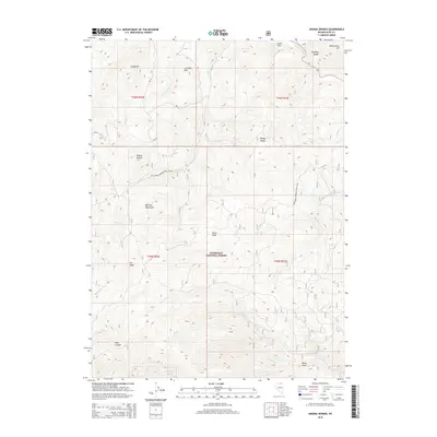
2015 Map of Ungina Wongo
USGS Topo · Published 2015About this map
The Bull Run Mountains and the northern reaches of the Humboldt National Forest dominate this high-desert landscape in Elko County. The terrain is defined by a series of prominent peaks and plateaus, including Ungina Wongo, Wonga Douya, and Siciegotit, which rise above a network of drainages that feed the Owyhee River to the northeast. This 2015 survey illustrates a wilderness primarily managed for conservation and forestry, where named landmarks like Gondem Bah and Fly Head provide orientation across the ridges. Evidence of human infrastructure is limited to primitive travel ways such as the Natl Forest Develop Road 178 Rd, highlighting the remote character of the Bruneau Range transition. Water remains the primary architect of the land here, carving deep features like Wall Canyon and Banty Gulch that contrast with the open space of Picnic Flats.
Find a feature on this map
32 named features on this map. Tap any name to fly to it.
Don’t see what you’re looking for? This feature index may not catch every label — zoom into the map to look around manually.
Map Details
Editions of this 2015 Ungina Wongo Map
This is the sole edition of this map. No revisions or reprints were ever made.
Other maps of this area

1936 · Mountain City
USGS Topo · 1:62,500

1939 · Owyhee
USGS Topo · 1:62,500

1940 · Mountain City
USGS Topo · 1:62,500

1942 · Owyhee
USGS Topo · 1:62,500

1955 · McDermitt
USGS Topo · 1:250,000

1955 · Wells
USGS Topo · 1:250,000

1956 · Bull Run
USGS Topo · 1:62,500

1956 · Wild Horse
USGS Topo · 1:62,500

1958 · Wells
USGS Topo · 1:250,000

1959 · McDermitt
USGS Topo · 1:250,000