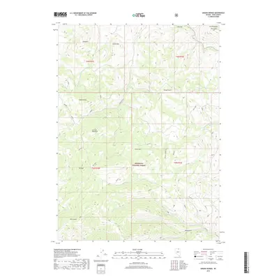
2018 Map of Ungina Wongo
USGS Topo · Published 2018About this map
The Humboldt National Forest dominates this section of Elko County, where the high-altitude terrain of the Bruneau Range meets the Bull Run Mountains. This 2018 survey reveals a landscape defined by significant elevation changes, from the heights of Ungina Wongo and Wonga Douya down to the drainage of the Owyhee River in the northeast. The area is intersected by a network of specialized access routes, including Partridge Road, Byington, and the series of McCall trails, which facilitate movement through the complex topography of Wall Canyon and Banty Gulch. For those tracing historical land use or grazing routes, the map identifies specific locales like Jones Flat, Picnic Flats, and Gondem Bah, which reflect the remote and rugged character of the Nevada backcountry during the early 21st century.
Find a feature on this map
46 named features on this map. Tap any name to fly to it.
Don’t see what you’re looking for? This feature index may not catch every label — zoom into the map to look around manually.
Map Details
Editions of this 2018 Ungina Wongo Map
This is the sole edition of this map. No revisions or reprints were ever made.
Other maps of this area

1936 · Mountain City
USGS Topo · 1:62,500

1939 · Owyhee
USGS Topo · 1:62,500

1940 · Mountain City
USGS Topo · 1:62,500

1942 · Owyhee
USGS Topo · 1:62,500

1955 · McDermitt
USGS Topo · 1:250,000

1955 · Wells
USGS Topo · 1:250,000

1956 · Bull Run
USGS Topo · 1:62,500

1956 · Wild Horse
USGS Topo · 1:62,500

1958 · Wells
USGS Topo · 1:250,000

1959 · McDermitt
USGS Topo · 1:250,000