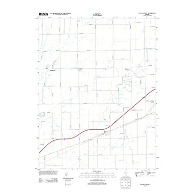
2012 Map of Union Center
USGS Topo · Published 2012About this map
Union Center and Maple Point anchor a landscape of high prairie and meandering creek bottoms in Clark County. This 2012 depiction of the Illinois countryside shows a robust network of county roads, such as Co Rd 2100 and Maple Point Rd, that navigate around numerous family and community burial grounds including Union Cem, Nebo Cem, and the uniquely named Duck Pond Cem. The drainage patterns are clearly defined by Hurricane Cr, Range Cr, and Birch Cr, which flow through the agricultural tracts. Near the southern edge, the settlement of Vevay Park sits adjacent to Etlebrick Lake and the interstate corridor, while the Casey Municipal Airport serves as a modern transportation hub on the eastern border. This map provides genealogists a precise record of cemetery locations that often mark the sites of early pioneer settlements and farmsteads.
Find a feature on this map
77 named features on this map. Tap any name to fly to it.
Don’t see what you’re looking for? This feature index may not catch every label — zoom into the map to look around manually.
Map Details
Editions of this 2012 Union Center Map
This is the sole edition of this map. No revisions or reprints were ever made.
Other maps of this area

1933 · Toledo
USGS Topo · 1:62,500

1936 · Casey
USGS Topo · 1:48,000

1938 · Toledo
USGS Topo · 1:62,500

1940 · Greenup
USGS Topo · 1:62,500

1942 · Casey
USGS Topo · 1:62,500

1943 · Greenup
USGS Topo · 1:62,500

1943 · Casey
USGS Topo · 1:62,500

1953 · Indianapolis
USGS Topo · 1:250,000

1956 · Indianapolis
USGS Topo · 1:250,000

1956 · Annapolis
USGS Topo · 1:62,500