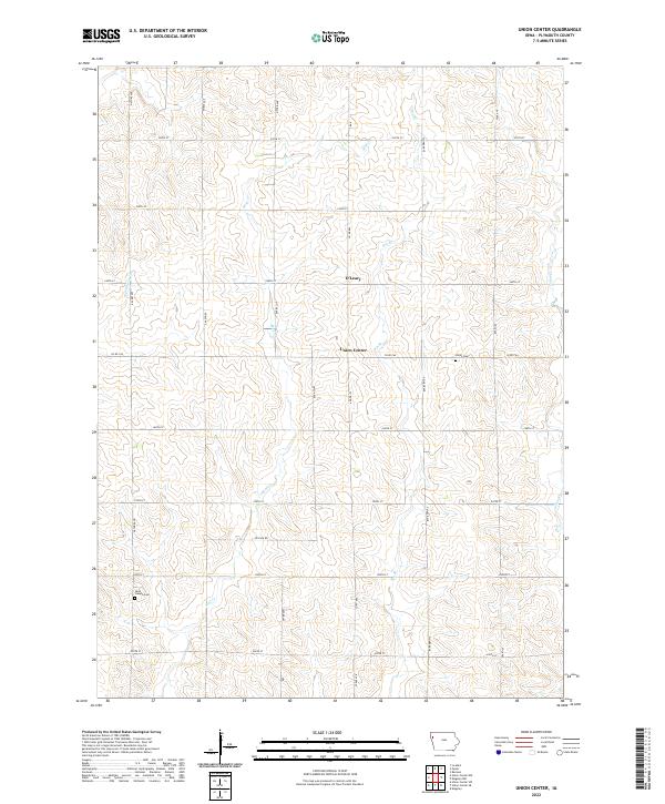
2022 Map of Union Center
USGS Topo · Published 2022About this map
Union Center and the neighboring settlement of O'Leary anchor this agricultural landscape in Plymouth County, which maintains a grid-based rural structure typical of Northwest Iowa. The territory is defined by a dense network of country roads including Nature Ave, Otter Ave, and Pioneer Ave, which facilitate the movement of goods and livestock across the prairie. For those documenting local families, the presence of Union Cem near the center of the quadrangle and Saint Joseph Cem to the southwest provides critical touchpoints for genealogical research. The terrain is drained by several meandering waterways such as Mud Cr, Big Whiskey Cr, and Johns Cr, which cut through the farmsteads and influence the placement of the township's secondary roads.
Find a feature on this map
31 named features on this map. Tap any name to fly to it.
Don’t see what you’re looking for? This feature index may not catch every label — zoom into the map to look around manually.
Map Details
Editions of this 2022 Union Center Map
This is the sole edition of this map. No revisions or reprints were ever made.
Other maps of this area

1954 · Fort Dodge
USGS Topo · 1:250,000

1955 · Sioux City
USGS Topo · 1:250,000

1957 · Fort Dodge
USGS Topo · 1:250,000

1958 · Sioux City
USGS Topo · 1:250,000

1958 · Fort Dodge
USGS Topo · 1:250,000

1959 · Sioux City
USGS Topo · 1:250,000

1962 · Le Mars
USGS Topo · 1:62,500

1962 · Union Center
USGS Topo · 1:62,500
1969 · Kingsley
USGS Topo · 1:24,000
1969 · Remsen
USGS Topo · 1:24,000