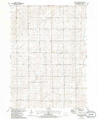
1985 Map of Union Center
USGS Topo · Published 1986About this map
The agrarian landscape of Plymouth County is meticulously documented in this mid-1980s topographic study, focusing on the township intersections of Union, Marion, Lincoln, and Elkhorn. The small settlement of Union Center serves as a central landmark, supported by local institutions like Union Ch and the adjacent Union Cem. To the south, St Josephs Ch stands near the border of Lincoln township, illustrating the dispersed but organized community structure typical of Iowa's farming regions.
Find a feature on this map
15 named features on this map. Tap any name to fly to it.
Don’t see what you’re looking for? This feature index may not catch every label — zoom into the map to look around manually.
Map Details
Editions of this 1985 Union Center Map
This is the sole edition of this map. No revisions or reprints were ever made.
Other maps of this area

1954 · Fort Dodge
USGS Topo · 1:250,000

1955 · Sioux City
USGS Topo · 1:250,000

1957 · Fort Dodge
USGS Topo · 1:250,000

1958 · Sioux City
USGS Topo · 1:250,000

1958 · Fort Dodge
USGS Topo · 1:250,000

1959 · Sioux City
USGS Topo · 1:250,000

1962 · Le Mars
USGS Topo · 1:62,500

1962 · Union Center
USGS Topo · 1:62,500
1969 · Kingsley
USGS Topo · 1:24,000
1969 · Remsen
USGS Topo · 1:24,000