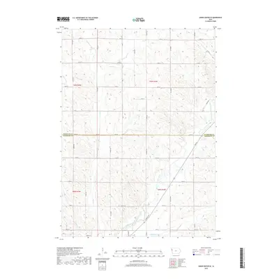
2018 Map of Union Center SE
USGS Topo · Published 2018About this map
The West Fork Little Sioux River carves a winding path through the borderlands of Woodbury and Plymouth counties in this 2018 survey. The landscape is defined by the precise section-line grid of the Public Land Survey System, where north-south thoroughfares like Humboldt Ave and Garner Ave intersect an extensive network of rural roads. This agricultural territory is drained by several named tributaries, including Mud Cr and Dry Br, which dictate the subtle topography of the prairie. Local commerce and transit are centered on significant routes such as Co Hwy D18 and Co Rd C64, reflecting the modern rural infrastructure of northwestern Iowa. Near the southern edge of the map, the transition toward local settlements is marked by E Main St and McElhaney Cr.
Find a feature on this map
37 named features on this map. Tap any name to fly to it.
Don’t see what you’re looking for? This feature index may not catch every label — zoom into the map to look around manually.
Map Details
Editions of this 2018 Union Center SE Map
This is the sole edition of this map. No revisions or reprints were ever made.
Other maps of this area

1954 · Fort Dodge
USGS Topo · 1:250,000

1955 · Sioux City
USGS Topo · 1:250,000

1957 · Fort Dodge
USGS Topo · 1:250,000

1958 · Sioux City
USGS Topo · 1:250,000

1958 · Fort Dodge
USGS Topo · 1:250,000

1959 · Sioux City
USGS Topo · 1:250,000

1962 · Union Center
USGS Topo · 1:62,500

1964 · Lawton
USGS Topo · 1:24,000

1964 · Moville
USGS Topo · 1:24,000

1969 · Correctionville NW
USGS Topo · 1:24,000