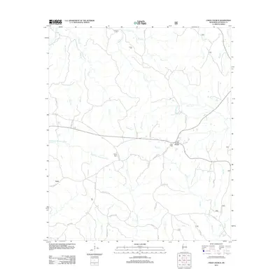
2012 Map of Union Church
USGS Topo · Published 2012About this map
Union Church and the settlement of Perth anchor this landscape in Southwest Mississippi, where the headwaters of the Middle Fork Homochitto River and its numerous tributaries have carved the terrain. The map reveals a high concentration of small, family-named burial grounds and community landmarks that speak to the area's deep rural roots. From the Singletary Cem and Norton Cem in the north to the Buie Cem near the Middle Fork Homochitto River, these sites provide a clear picture of the local genealogy and settlement patterns. The road network, including Union Church Rd and Meadeville Rd, connects these remote outposts across a landscape defined by watercourses like Singletary Cr and Fifteenmile Cr. The presence of the Post Office at Union Church highlights its role as a regional crossroads for this part of Jefferson County.
Find a feature on this map
50 named features on this map. Tap any name to fly to it.
Don’t see what you’re looking for? This feature index may not catch every label — zoom into the map to look around manually.
Map Details
Editions of this 2012 Union Church Map
This is the sole edition of this map. No revisions or reprints were ever made.
Other maps of this area

1953 · Natchez
USGS Topo · 1:250,000

1956 · Natchez
USGS Topo · 1:250,000

1959 · Natchez
USGS Topo · 1:250,000

1963 · Red Lick
USGS Topo · 1:24,000

1963 · Union Church
USGS Topo · 1:62,500

1963 · McBride
USGS Topo · 1:24,000

1963 · Barlow
USGS Topo · 1:24,000

1972 · McCall Creek
USGS Topo · 1:24,000

1972 · Caseyville
USGS Topo · 1:24,000

1984 · Brookhaven
USGS Topo · 1:100,000