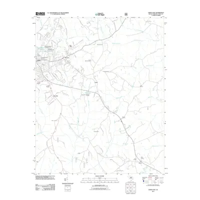
2011 Map of Union East
USGS Topo · Published 2011About this map
The University of South Carolina Regional Campus serves as a modern anchor for the eastern side of Union, where the city’s residential streets begin to yield to the creek-carved landscape of the Piedmont. In the early 21st century, this area shows a transition from the industrial and urbanized corridors of Monarch and New Hill to the rural expanses surrounding Santuc and Carem. The map records an extensive network of family and community burial grounds, including Rosemont Cemetery, Hebron Cemetery, and Cane Creek Cemetery, which offer valuable locations for genealogical research.
Find a feature on this map
93 named features on this map. Tap any name to fly to it.
Don’t see what you’re looking for? This feature index may not catch every label — zoom into the map to look around manually.
Map Details
Editions of this 2011 Union East Map
This is the sole edition of this map. No revisions or reprints were ever made.
Other maps of this area

1907 · Sharon
USGS Topo · 1:62,500

1941 · Spartanburg
USGS Topo · 1:250,000

1953 · Spartanburg
USGS Topo · 1:250,000

1960 · Spartanburg
USGS Topo · 1:250,000

1963 · Spartanburg
USGS Topo · 1:250,000

1964 · Spartanburg
USGS Topo · 1:250,000

1969 · Union West
USGS Topo · 1:24,000

1969 · Sedalia
USGS Topo · 1:24,000
1969 · Carlisle
USGS Topo · 1:24,000

1969 · Kelton
USGS Topo · 1:24,000