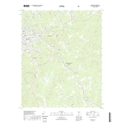
2020 Map of Union East
USGS Topo · Published 2020About this map
Union and the adjacent mill villages of Monarch and Monarch Mill define the industrial and residential core of this South Carolina landscape. The geography transitions from the urban street grid of the county seat, home to the University of South Carolina - Union and Grace United Methodist Church, into the dense wooded reaches of the Sumter National Forest. This expansive woodland is drained by a complex network of waterways, including Tinker Creek and Henry Creek, which flow southward toward the settlement of Santuc.
Find a feature on this map
109 named features on this map. Tap any name to fly to it.
Don’t see what you’re looking for? This feature index may not catch every label — zoom into the map to look around manually.
Map Details
Editions of this 2020 Union East Map
This is the sole edition of this map. No revisions or reprints were ever made.
Other maps of this area

1907 · Sharon
USGS Topo · 1:62,500

1941 · Spartanburg
USGS Topo · 1:250,000

1953 · Spartanburg
USGS Topo · 1:250,000

1960 · Spartanburg
USGS Topo · 1:250,000

1963 · Spartanburg
USGS Topo · 1:250,000

1964 · Spartanburg
USGS Topo · 1:250,000

1969 · Union West
USGS Topo · 1:24,000

1969 · Sedalia
USGS Topo · 1:24,000
1969 · Carlisle
USGS Topo · 1:24,000

1969 · Kelton
USGS Topo · 1:24,000