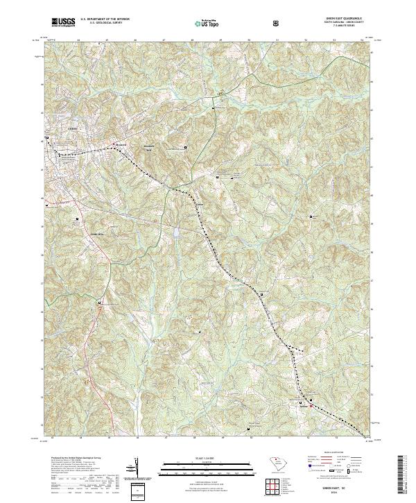
2024 Map of Union East
USGS Topo · Published 2024About this map
Union and its eastern industrial and residential extensions form the hub of this South Carolina landscape, where the textile heritage of Monarch Mill remains a central landmark. The transition from the city's denser streets to the rural south is marked by neighborhood developments like South Hills and the presence of the University of South Carolina - Union. Beyond the immediate outskirts of Monarch, the land opens into the Sumter National Forest, characterized by the complex drainage of Tinker Creek and Brushy Creek.
Find a feature on this map
118 named features on this map. Tap any name to fly to it.
Don’t see what you’re looking for? This feature index may not catch every label — zoom into the map to look around manually.
Map Details
Editions of this 2024 Union East Map
This is the sole edition of this map. No revisions or reprints were ever made.
Other maps of this area

1907 · Sharon
USGS Topo · 1:62,500

1941 · Spartanburg
USGS Topo · 1:250,000

1953 · Spartanburg
USGS Topo · 1:250,000

1960 · Spartanburg
USGS Topo · 1:250,000

1963 · Spartanburg
USGS Topo · 1:250,000

1964 · Spartanburg
USGS Topo · 1:250,000

1969 · Union West
USGS Topo · 1:24,000

1969 · Sedalia
USGS Topo · 1:24,000
1969 · Carlisle
USGS Topo · 1:24,000

1969 · Kelton
USGS Topo · 1:24,000