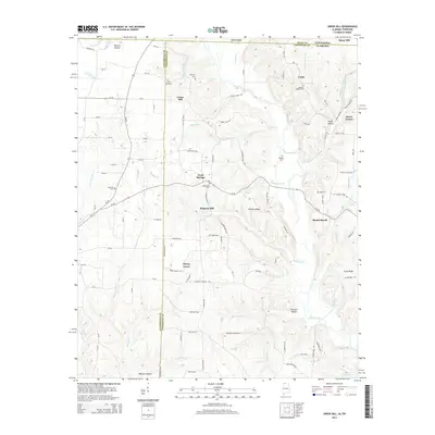
2014 Map of Union Hill
USGS Topo · Published 2014About this map
Sugar Creek and its many tributaries carve a network of ridges and hollows across the Tennessee-Alabama state line, defining the local geography of Giles County, Limestone County, and Lauderdale County. Small agrarian settlements and named crossroads like Good Springs, Union Hill, and Ridgway Mill anchor the landscape, connected by a web of county roads. The area is dotted with family and community burial grounds, including Hesters Chapel Cem and Oak Grove Cem, which serve as vital markers of the region's genealogical history.
Find a feature on this map
107 named features on this map. Tap any name to fly to it.
Don’t see what you’re looking for? This feature index may not catch every label — zoom into the map to look around manually.
Map Details
Editions of this 2014 Union Hill Map
This is the sole edition of this map. No revisions or reprints were ever made.
Other maps of this area

1914 · Rogersville
USGS Topo · 1:48,000

1916 · Rogersville
USGS Topo · 1:62,500

1936 · Union Hill
USGS Topo · 1:24,000

1936 · Aspen Hill
USGS Topo · 1:24,000

1936 · Thorntontown
USGS Topo · 1:24,000

1936 · Lexington
USGS Topo · 1:24,000

1936 · Ripley
USGS Topo · 1:24,000

1936 · Appleton
USGS Topo · 1:24,000

1936 · Cairo
USGS Topo · 1:24,000

1936 · Bonnertown
USGS Topo · 1:24,000