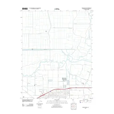
2012 Map of Union Island
USGS Topo · Published 2012About this map
Union Island is defined by an intricate network of waterways and levee-protected tracts just west of the Central Valley. The landscape reveals a sophisticated irrigation and drainage system dominated by the Grant Line Canal and the Fabian and Bell Canal, which frame the northern agricultural fields. These man-made channels intersect with natural meandering features like Old River and Salmon Slough, illustrating the century-long effort to reclaim the San Joaquin Delta for productive use.
Find a feature on this map
69 named features on this map. Tap any name to fly to it.
Don’t see what you’re looking for? This feature index may not catch every label — zoom into the map to look around manually.
Map Details
Editions of this 2012 Union Island Map
This is the sole edition of this map. No revisions or reprints were ever made.
Other maps of this area

1907 · Tesla
USGS Topo · 1:62,500

1913 · Woodward Island
USGS Topo · 1:31,680

1913 · Stockton
USGS Topo · 1:31,680

1913 · Holt
USGS Topo · 1:31,680

1914 · Bethany
USGS Topo · 1:31,680

1914 · Union Island
USGS Topo · 1:31,680

1915 · Vernalis
USGS Topo · 1:31,680

1915 · Lathrop
USGS Topo · 1:31,680

1916 · Byron
USGS Topo · 1:62,500

1916 · Tracy
USGS Topo · 1:31,680