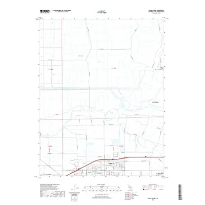
2018 Map of Union Island
USGS Topo · Published 2018About this map
Union Island and the surrounding delta lowlands of the San Joaquin Valley define this modern landscape of engineered waterways and agricultural tracts. Situated between the growing cities of Tracy and Lathrop, the area is a network of managed watercourses including the Grant Line Canal, Fabian and Bell Canal, and several natural sloughs. The map illustrates how human development has adapted to the Sacramento-San Joaquin River Delta, with levees such as S Wing Levee Rd and drainage features like Paradise Cut and Sugar Cut protecting the fertile island soils. While the southern portion near Tracy shows industrial and residential expansion along Byron Rd and W Grant Line Rd, the north remains largely defined by the agricultural geometry of Union Island and Roberts Island, reflecting the long-standing importance of this region to California's agricultural economy.
Find a feature on this map
87 named features on this map. Tap any name to fly to it.
Don’t see what you’re looking for? This feature index may not catch every label — zoom into the map to look around manually.
Map Details
Editions of this 2018 Union Island Map
This is the sole edition of this map. No revisions or reprints were ever made.
Other maps of this area

1907 · Tesla
USGS Topo · 1:62,500

1913 · Woodward Island
USGS Topo · 1:31,680

1913 · Stockton
USGS Topo · 1:31,680

1913 · Holt
USGS Topo · 1:31,680

1914 · Bethany
USGS Topo · 1:31,680

1914 · Union Island
USGS Topo · 1:31,680

1915 · Vernalis
USGS Topo · 1:31,680

1915 · Lathrop
USGS Topo · 1:31,680

1916 · Byron
USGS Topo · 1:62,500

1916 · Tracy
USGS Topo · 1:31,680