
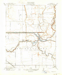
1914 Map of Union Island
USGS Topo · Published 1914About this map
Union Island and the surrounding San Joaquin Delta are defined here by a complex hydraulic landscape of natural waterways and early 20th-century irrigation engineering. This 1914 survey illustrates the intricate network of the Old River and Middle River as they weave through low-lying tracts, supplemented by man-made channels like the Grant Line Canal and the Fabian and Bell Canal. These waterways were critical for transforming the delta into productive agricultural land, a process overseen by state engineers like W. F. McClure.
Find a feature on this map
13 named features on this map. Tap any name to fly to it.
Don’t see what you’re looking for? This feature index may not catch every label — zoom into the map to look around manually.
Map Details
Editions of this 1914 Union Island Map
2 editions found
Other maps of this area

1907 · Tesla
USGS Topo · 1:62,500

1913 · Woodward Island
USGS Topo · 1:31,680

1913 · Stockton
USGS Topo · 1:31,680

1913 · Holt
USGS Topo · 1:31,680

1914 · Bethany
USGS Topo · 1:31,680

1915 · Vernalis
USGS Topo · 1:31,680

1915 · Lathrop
USGS Topo · 1:31,680

1916 · Byron
USGS Topo · 1:62,500

1916 · Tracy
USGS Topo · 1:31,680

1916 · Midway
USGS Topo · 1:31,680