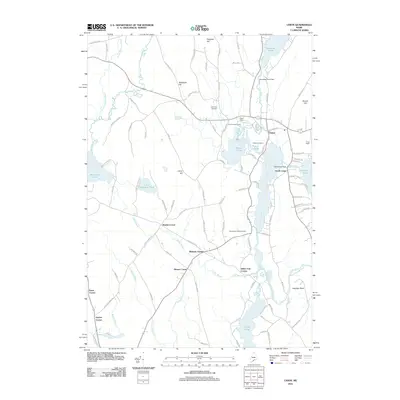
2011 Map of Union
USGS Topo · Published 2011About this map
Union and South Union serve as the primary hubs of this landscape, situated along the Saint George River and the shores of Sennebec Pond. This 2011 survey reveals a rural network defined by historical crossroads and small-scale water management, evidenced by the Sennebec Pond Dam and Mill Stream Dam. The area is marked by numerous family-named junctions such as Manks Corner, Whitney Corner, and Feylers Corner, which often represent long-standing property lines and local landmarks in Knox County history. For genealogists, the map provides precise locations for the Village Cemetery, Lake View Cemetery, and Post Sunny View Cemetery. The terrain is characterized by a series of prominent rises including Clarry Hill and Shepards Hill, while the Union Fairgrounds and Clark Field highlight the community's established social and recreational centers.
Find a feature on this map
96 named features on this map. Tap any name to fly to it.
Don’t see what you’re looking for? This feature index may not catch every label — zoom into the map to look around manually.
Map Details
Editions of this 2011 Union Map
This is the sole edition of this map. No revisions or reprints were ever made.
Other maps of this area

1904 · Rockland
USGS Topo · 1:62,500

1906 · Rockland
USGS Topo · 1:62,500

1913 · Waldoboro
USGS Topo · 1:48,000

1915 · Waldoboro
USGS Topo · 1:62,500

1915 · Belfast
USGS Topo · 1:62,500

1916 · Liberty
USGS Topo · 1:62,500

1917 · Belfast
USGS Topo · 1:62,500

1941 · Belfast
USGS Topo · 1:62,500

1941 · Rockland
USGS Topo · 1:62,500

1941 · Waldoboro
USGS Topo · 1:62,500