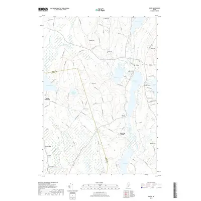
2018 Map of Union
USGS Topo · Published 2018About this map
The Saint George River flows through a chain of major water bodies in this Knox County landscape, connecting Sennebec Pond in the north to Round Pond and Seven Tree Pond at the heart of the region. The settlement of Union serves as a focal point, situated between the river and the heights of Barrett Hill. This area is defined by its transition from the river valley to prominent elevations like Clarry Hill and Coggans Hill, which overlook a network of smaller brooks and ponds, including Medomak Pond and White Oak Pond.
Find a feature on this map
93 named features on this map. Tap any name to fly to it.
Don’t see what you’re looking for? This feature index may not catch every label — zoom into the map to look around manually.
Map Details
Editions of this 2018 Union Map
This is the sole edition of this map. No revisions or reprints were ever made.
Other maps of this area

1904 · Rockland
USGS Topo · 1:62,500

1906 · Rockland
USGS Topo · 1:62,500

1913 · Waldoboro
USGS Topo · 1:48,000

1915 · Waldoboro
USGS Topo · 1:62,500

1915 · Belfast
USGS Topo · 1:62,500

1916 · Liberty
USGS Topo · 1:62,500

1917 · Belfast
USGS Topo · 1:62,500

1941 · Belfast
USGS Topo · 1:62,500

1941 · Rockland
USGS Topo · 1:62,500

1941 · Waldoboro
USGS Topo · 1:62,500