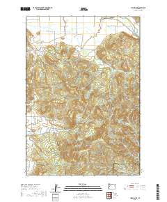
2020 Map of Union Point
USGS Topo · Published 2020About this map
Diamond Hill anchors the western edge of this landscape where the floor of the Willamette Valley meets the rising foothills of the Cascades. The 2020 survey documents the complex drainage network of this boundary area between Linn and Lane counties, defined by the winding course of the Calapooia River in the northeast and numerous seasonal and perennial streams like Tub Run, Pierce Creek, and Shotgun Creek. The terrain transitions from rural valley roads such as Orchard Drive and Gap Road into the significant elevations of Bald Mountain, Horse Rock, and Cougar Ridge. These prominent landforms dictate the local road patterns, with routes like Courtney Creek Drive following the natural contours of the drainage basins. Notable landmarks like the McKercher Bridge emphasize the historically vital crossings along the river systems that have long shaped the region's movement and development.
Find a feature on this map
35 named features on this map. Tap any name to fly to it.
Don’t see what you’re looking for? This feature index may not catch every label — zoom into the map to look around manually.
Map Details
Editions of this 2020 Union Point Map
This is the sole edition of this map. No revisions or reprints were ever made.
Other maps of this area

1909 · Rowland
USGS Topo · 1:31,680

1910 · Eugene
USGS Topo · 1:62,500

1911 · Brownsville
USGS Topo · 1:31,680

1912 · Halsey
USGS Topo · 1:62,500

1921 · Brownsville
USGS Topo · 1:62,500

1940 · Eugene
USGS Topo · 1:62,500

1941 · Halsey
USGS Topo · 1:62,500

1946 · Eugene
USGS Topo · 1:62,500

1949 · Eugene
USGS Topo · 1:62,500

1950 · Marcola
USGS Topo · 1:62,500