
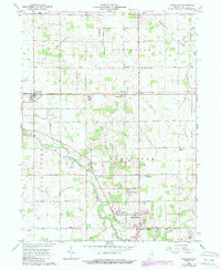
1962 Map of Uniondale
USGS Topo · Published 1963About this map
The Indian Treaty Boundary cuts diagonally through this portion of Wells County, separating the townships of Jefferson and Union. At the center of the regional transport network, the Wabash River meanders toward the southwest, its banks hosting the Murray Conservation Club and the settlement of Murray. The landscape is a study in mid-century rural infrastructure, where the Erie-Lackawanna railroad intersects with small agricultural hubs like Uniondale and Kingsland.
Find a feature on this map
49 named features on this map. Tap any name to fly to it.
Don’t see what you’re looking for? This feature index may not catch every label — zoom into the map to look around manually.
Map Details
Editions of this 1962 Uniondale Map
2 editions found
Other maps of this area

1953 · Muncie
USGS Topo · 1:250,000

1955 · Markle
USGS Topo · 1:24,000

1956 · Muncie
USGS Topo · 1:250,000
1961 · Zanesville
USGS Topo · 1:24,000

1962 · Poe
USGS Topo · 1:24,000

1962 · Ossian
USGS Topo · 1:24,000

1962 · Liberty Center
USGS Topo · 1:24,000

1962 · Preble
USGS Topo · 1:24,000

1962 · Linn Grove
USGS Topo · 1:24,000
1962 · Bluffton
USGS Topo · 1:24,000