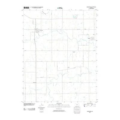
2009 Map of Uniontown
USGS Topo · Published 2009About this map
Uniontown and Redfield anchor the landscape of western Bourbon County, where the meandering course of the Marmaton River flows eastward through a grid of rural roads. This 2009 survey reveals a topography shaped by small tributaries including Turkey Creek, Paint Creek, and Bunton Creek. The layout of the region is defined by long-established section-line roads such as Grand Rd and Hackberry Rd, which connect scattered homesteads to the smaller settlement of Petersburg. For genealogists and local historians, the map identifies several significant burial grounds, including Woods Cemetery, Mount Zion Cemetery, and Marion Cemetery. These landmarks, along with the distinct naming of drainage features like Opossum Hollow, provide a detailed look at the agricultural character and persistent rural community structure of this Kansas heartland in the early 21st century.
Find a feature on this map
36 named features on this map. Tap any name to fly to it.
Don’t see what you’re looking for? This feature index may not catch every label — zoom into the map to look around manually.
Map Details
Editions of this 2009 Uniontown Map
This is the sole edition of this map. No revisions or reprints were ever made.
Other maps of this area

1884 · Fort Scott
USGS Topo · 1:125,000

1886 · Iola
USGS Topo · 1:125,000

1886 · Fort Scott
USGS Topo · 1:125,000

1893 · Fort Scott
USGS Topo · 1:125,000

1893 · Iola
USGS Topo · 1:125,000

1904 · Iola
USGS Topo · 1:125,000

1947 · Joplin
USGS Topo · 1:250,000

1948 · Erie
USGS Topo · 1:62,500

1948 · Girard
USGS Topo · 1:62,500

1949 · Erie
USGS Topo · 1:62,500