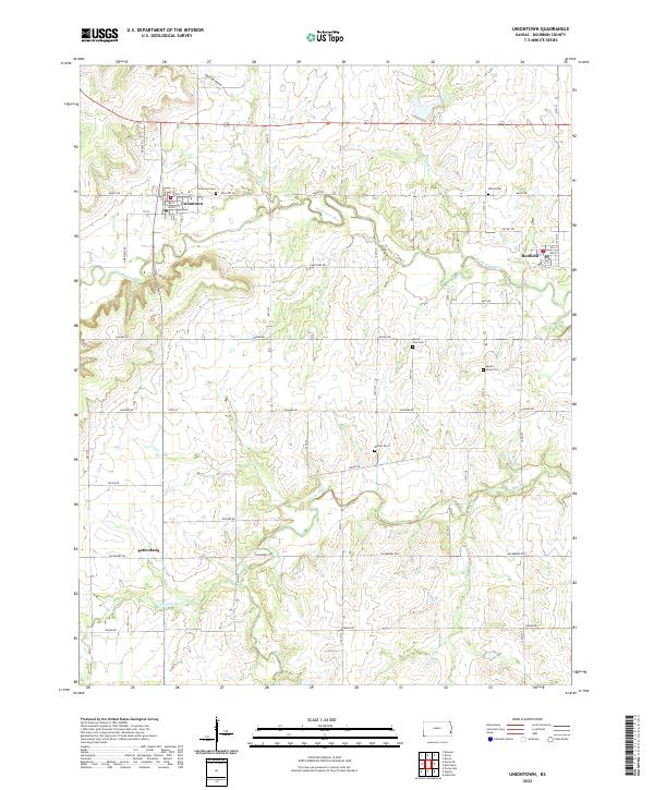
2022 Map of Uniontown
USGS Topo · Published 2022About this map
Uniontown sits at the northern end of this Bourbon County landscape, where the Marmaton River and Turkey Cr define the drainage patterns of the upper prairie. The settlement geography of the area is anchored by the villages of Redfield and Petersburg, connected by a grid of named rural roads like Jayhawk Rd and Indian Rd. For researchers, the distribution of local burial grounds, including Uniontown Cem, Mount Orum Cem, and Marion Cem, provides a clear view of how family and community clusters were established across townships T25S and T26S. To the south, Paint Creek and Hinton Creek carve through the terrain, illustrating the transition from open farmland to the more varied topography of Opossum Hollow. The map traces a modern infrastructure laid over long-established boundaries, showing the persistence of early Kansas settlement patterns.
Find a feature on this map
40 named features on this map. Tap any name to fly to it.
Don’t see what you’re looking for? This feature index may not catch every label — zoom into the map to look around manually.
Map Details
Editions of this 2022 Uniontown Map
This is the sole edition of this map. No revisions or reprints were ever made.
Other maps of this area

1884 · Fort Scott
USGS Topo · 1:125,000

1886 · Iola
USGS Topo · 1:125,000

1886 · Fort Scott
USGS Topo · 1:125,000

1893 · Fort Scott
USGS Topo · 1:125,000

1893 · Iola
USGS Topo · 1:125,000

1904 · Iola
USGS Topo · 1:125,000

1947 · Joplin
USGS Topo · 1:250,000

1948 · Erie
USGS Topo · 1:62,500

1948 · Girard
USGS Topo · 1:62,500

1949 · Erie
USGS Topo · 1:62,500