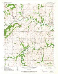
1966 Map of Uniontown
USGS Topo · Published 1967About this map
Uniontown and Redfield anchor this mid-1960s snapshot of Bourbon County, where the agricultural landscape is deeply etched by the winding course of the Marmaton River. The map reveals a transition in transportation, notably recording an Old Railroad Grade that once connected these rural centers. A significant historical marker, the Old Indian Treaty Boundary, cuts across the southern portion of the sheet near Pawnee Creek, providing a geographic anchor to the region's early settlement history.
Find a feature on this map
28 named features on this map. Tap any name to fly to it.
Don’t see what you’re looking for? This feature index may not catch every label — zoom into the map to look around manually.
Map Details
Editions of this 1966 Uniontown Map
This is the sole edition of this map. No revisions or reprints were ever made.
Other maps of this area

1884 · Fort Scott
USGS Topo · 1:125,000

1886 · Iola
USGS Topo · 1:125,000

1886 · Fort Scott
USGS Topo · 1:125,000

1893 · Fort Scott
USGS Topo · 1:125,000

1893 · Iola
USGS Topo · 1:125,000

1904 · Iola
USGS Topo · 1:125,000

1947 · Joplin
USGS Topo · 1:250,000

1948 · Erie
USGS Topo · 1:62,500

1948 · Girard
USGS Topo · 1:62,500

1949 · Erie
USGS Topo · 1:62,500