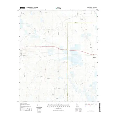
2014 Map of Uniontown East
USGS Topo · Published 2014About this map
The boundary between Perry and Dallas counties bisects this rural landscape, which is defined by the headwaters of numerous creeks and several small communities along the Us-80 corridor. The settlement of Uniontown sits at the western edge, where its grid extends to include the Ellawhite Cemetery. To the east, the rural settlements of Hillcrest, Tayloe, Trinity, and Bellevue are interconnected by a network of county roads like Tayloe Road and CR-12. The landscape is primarily agrarian and hydrological, featuring the significant Marion Weissinger Lake Number One in the southeast. Numerous family and community cemeteries, such as Pickens Cemetery and Living Hope Cemetery, are scattered throughout the hills, providing valuable points of interest for genealogists tracking local ancestry in this part of the Alabama Black Belt.
Find a feature on this map
38 named features on this map. Tap any name to fly to it.
Don’t see what you’re looking for? This feature index may not catch every label — zoom into the map to look around manually.
Map Details
Editions of this 2014 Uniontown East Map
This is the sole edition of this map. No revisions or reprints were ever made.
Other maps of this area

1953 · Montgomery
USGS Topo · 1:250,000

1956 · Montgomery
USGS Topo · 1:250,000

1957 · Montgomery
USGS Topo · 1:250,000

1968 · Thomaston East
USGS Topo · 1:24,000

1968 · Uniontown West
USGS Topo · 1:24,000

1968 · Uniontown East
USGS Topo · 1:24,000

1968 · Browns
USGS Topo · 1:24,000

1968 · Safford
USGS Topo · 1:24,000

1968 · Central Mills
USGS Topo · 1:24,000

1979 · Scott Station
USGS Topo · 1:24,000