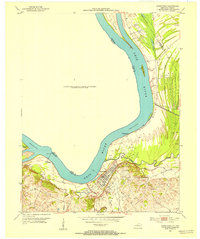
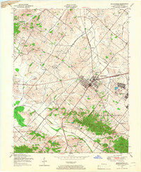
1952 Map of Uniontown
USGS Topo · Published 1954About this map
Uniontown sits at a sharp bend in the Ohio River, serving as a focal point for commerce and industry during the early 1950s. The landscape is defined by the heavy presence of Oil Wells scattered to the south and east, while the river itself remains a vital artery, featuring a Ferry crossing and Dam No 49 near Wabash Island. This era shows the intersection of military and civil infrastructure with the Camp Breckinridge Pumping Sta located just north of the town center.
Find a feature on this map
28 named features on this map. Tap any name to fly to it.
Don’t see what you’re looking for? This feature index may not catch every label — zoom into the map to look around manually.
Map Details
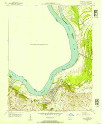
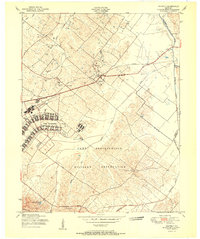
Editions of this 1952 Uniontown Map
2 editions found
Other maps of this area

1905 · New Haven
USGS Topo · 1:62,500

1906 · New Haven
USGS Topo · 1:62,500

1907 · Morganfield
USGS Topo · 1:62,500

1916 · Shawneetown
USGS Topo · 1:62,500
1917 · Uniontown
USGS Topo · 1:62,500

1949 · Paducah
USGS Topo · 1:250,000
1949 · New Haven
USGS Topo · 1:62,500
1949 · Morganfield
USGS Topo · 1:24,000

1950 · Paducah
USGS Topo · 1:250,000
1951 · Waverly
USGS Topo · 1:24,000