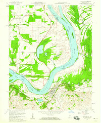
1958 Map of Uniontown
USGS Topo · Published 1959About this map
The Ohio River dominates this landscape, serving as the fluid border between Union County, Kentucky, and Posey County, Indiana. This mid-century survey reveals a riverine economy transitioning between traditional agriculture and modern industrial development, highlighted by the concentration of Oil Wells scattered across the floodplains and lowlands. In Kentucky, the town of Uniontown serves as the primary hub, where local history is recorded at St Agnes Ch and the Uniontown Cem.
Find a feature on this map
29 named features on this map. Tap any name to fly to it.
Don’t see what you’re looking for? This feature index may not catch every label — zoom into the map to look around manually.
Map Details
Editions of this 1958 Uniontown Map
2 editions found
Other maps of this area

1905 · New Haven
USGS Topo · 1:62,500

1906 · New Haven
USGS Topo · 1:62,500

1907 · Morganfield
USGS Topo · 1:62,500

1916 · Shawneetown
USGS Topo · 1:62,500

1917 · Uniontown
USGS Topo · 1:62,500

1949 · Paducah
USGS Topo · 1:250,000

1949 · New Haven
USGS Topo · 1:62,500

1949 · Morganfield
USGS Topo · 1:24,000

1950 · Paducah
USGS Topo · 1:250,000

1951 · Waverly
USGS Topo · 1:24,000