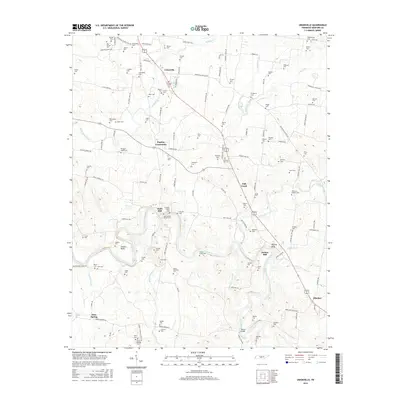
2016 Map of Unionville
USGS Topo · Published 2016About this map
Unionville and the surrounding Bedford County countryside are defined by a dense network of family cemeteries and historic crossings along the Duck River. This landscape reflects generations of settlement, with significant clusters of sites near Poplins Crossroads and the milling communities of Halls Mill and Anchor Mill. The geography is intricately carved by numerous waterways, including North Fork Creek and Weakly Creek, which dictate the placement of early homesteads and churchyards. Genealogists will find a wealth of records in the numerous burial sites such as Crowells Chapel Cem, Bethlehem Cem, and Lentz-Williams Cem. To the south, the Duck River meanders through Shearin Bend past Tarpley Bluff, where Warner Bridge provides a key passage point. The distribution of these features reveals a persistent rural character where small settlements like Elbethel and Sims Spring remain anchored by their local names and natural landmarks.
Find a feature on this map
139 named features on this map. Tap any name to fly to it.
Don’t see what you’re looking for? This feature index may not catch every label — zoom into the map to look around manually.
Map Details
Editions of this 2016 Unionville Map
This is the sole edition of this map. No revisions or reprints were ever made.
Other maps of this area

1936 · Chapel Hill
USGS Topo · 1:24,000

1936 · Farmington
USGS Topo · 1:24,000

1936 · Shelbyville
USGS Topo · 1:24,000

1936 · Rover
USGS Topo · 1:24,000

1936 · Belfast
USGS Topo · 1:24,000

1936 · Deason
USGS Topo · 1:24,000

1936 · Unionville
USGS Topo · 1:24,000

1936 · Bedford
USGS Topo · 1:24,000

1936 · Fosterville
USGS Topo · 1:24,000

1944 · Shelbyville
USGS Topo · 1:100,000