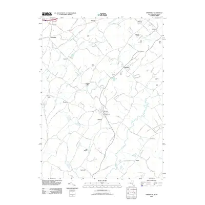
2011 Map of Unionville
USGS Topo · Published 2011About this map
Unionville and Westtown anchor this agricultural and residential landscape in the early twenty-first century, positioned where the Wallkill River winds through the borderlands of Orange County and New Jersey. The map highlights a long-standing agricultural tradition, naming several distinct family operations such as Keiths Farm, Kezialain Farm, and Sudol Farms, alongside specialized sites like the Rocky Bar Tree Farm and Sleepy Hills Orchard. Local infrastructure is marked by the presence of the Westtown Airport and the Green Ridge Golf Course, illustrating the modern utility of the land.
Find a feature on this map
139 named features on this map. Tap any name to fly to it.
Don’t see what you’re looking for? This feature index may not catch every label — zoom into the map to look around manually.
Map Details
Editions of this 2011 Unionville Map
This is the sole edition of this map. No revisions or reprints were ever made.
Other maps of this area

1888 · Franklin
USGS Topo · 1:62,500

1891 · Greenwood Lake
USGS Topo · 1:62,500

1893 · Greenwood Lake
USGS Topo · 1:62,500

1894 · Franklin
USGS Topo · 1:62,500

1897 · Franklin
USGS Topo · 1:62,500

1903 · Franklin Furnace
USGS Topo · 1:62,500

1903 · Greenwood Lake
USGS Topo · 1:62,500

1906 · Port Jervis
USGS Topo · 1:62,500

1906 · Goshen
USGS Topo · 1:62,500

1908 · Goshen
USGS Topo · 1:62,500