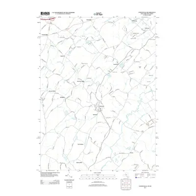
2013 Map of Unionville
USGS Topo · Published 2013About this map
Unionville and Westtown serve as focal points for this rural landscape along the New York and New Jersey border. The geography is defined by the winding course of the Wallkill River and Rutgers Cr, supporting a long-standing agricultural tradition evident in named properties like Sleepy Hills Orchard, Kezialain Farm, and the Rocky Bar Tree Farm. This 2013 survey reflects a blend of traditional land use and modern recreational development, featuring the Westtown Airport and Green Ridge Golf Course.
Find a feature on this map
166 named features on this map. Tap any name to fly to it.
Don’t see what you’re looking for? This feature index may not catch every label — zoom into the map to look around manually.
Map Details
Editions of this 2013 Unionville Map
This is the sole edition of this map. No revisions or reprints were ever made.
Other maps of this area

1888 · Franklin
USGS Topo · 1:62,500

1891 · Greenwood Lake
USGS Topo · 1:62,500

1893 · Greenwood Lake
USGS Topo · 1:62,500

1894 · Franklin
USGS Topo · 1:62,500

1897 · Franklin
USGS Topo · 1:62,500

1903 · Franklin Furnace
USGS Topo · 1:62,500

1903 · Greenwood Lake
USGS Topo · 1:62,500

1906 · Port Jervis
USGS Topo · 1:62,500

1906 · Goshen
USGS Topo · 1:62,500

1908 · Goshen
USGS Topo · 1:62,500