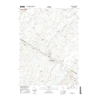
2016 Map of Unionville
USGS Topo · Published 2016About this map
Unionville and Westtown anchor this cross-border landscape, where the rural character of Orange County, New York, meets Sussex County, New Jersey. The terrain is defined by the broad Wallkill Valley, with the Wallkill River and its tributary Drumgoole Ditch winding through the southern lowlands. To the southwest, the Appalachian National Scenic Trail traverses the ridgelines near Pochuck Mtn, offering a preserved corridor through a region otherwise marked by agricultural plots and small hamlets like Waterloo Mills and Hanford. For those tracing local history, the map identifies significant burial sites including Unionville Cem and Minisink Cem. Numerous water bodies such as Willow Lake and Lockenhurst Pond illustrate the drainage patterns of the Rutgers Cr watershed, while small clusters of buildings at Quarryville and Van Syckles show the persistent footprint of small-scale 19th and 20th-century settlements.
Find a feature on this map
132 named features on this map. Tap any name to fly to it.
Don’t see what you’re looking for? This feature index may not catch every label — zoom into the map to look around manually.
Map Details
Editions of this 2016 Unionville Map
This is the sole edition of this map. No revisions or reprints were ever made.
Other maps of this area

1888 · Franklin
USGS Topo · 1:62,500

1891 · Greenwood Lake
USGS Topo · 1:62,500

1893 · Greenwood Lake
USGS Topo · 1:62,500

1894 · Franklin
USGS Topo · 1:62,500

1897 · Franklin
USGS Topo · 1:62,500

1903 · Franklin Furnace
USGS Topo · 1:62,500

1903 · Greenwood Lake
USGS Topo · 1:62,500

1906 · Port Jervis
USGS Topo · 1:62,500

1906 · Goshen
USGS Topo · 1:62,500

1908 · Goshen
USGS Topo · 1:62,500