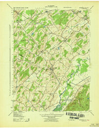
1943 Map of Unionville
USGS Topo · Published 1943About this map
Unionville and the surrounding farmland of Minisink and Greenville are captured in detail just before the mid-century, straddling the border of Orange and Sussex counties. This landscape is defined by its industrial and agricultural connectivity, where the New York Susquehanna and Western and Lehigh and New England railroads provide a backbone for local commerce. Industrial sites like the American Silk Label Co, Lewis Ringle Paper Co, and the Sussex Distillery highlight the productive nature of these small valley settlements.
Find a feature on this map
43 named features on this map. Tap any name to fly to it.
Don’t see what you’re looking for? This feature index may not catch every label — zoom into the map to look around manually.
Map Details
Editions of this 1943 Unionville Map
This is the sole edition of this map. No revisions or reprints were ever made.
Other maps of this area

1888 · Franklin
USGS Topo · 1:62,500

1891 · Greenwood Lake
USGS Topo · 1:62,500

1893 · Greenwood Lake
USGS Topo · 1:62,500

1894 · Franklin
USGS Topo · 1:62,500

1897 · Franklin
USGS Topo · 1:62,500

1903 · Franklin Furnace
USGS Topo · 1:62,500

1903 · Greenwood Lake
USGS Topo · 1:62,500

1906 · Port Jervis
USGS Topo · 1:62,500

1906 · Goshen
USGS Topo · 1:62,500

1908 · Goshen
USGS Topo · 1:62,500