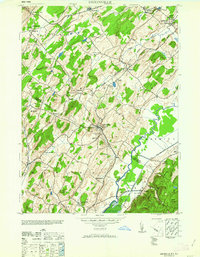
1963 Map of Unionville
USGS Topo · Published 1963About this map
Unionville and the surrounding borderlands of Greenville and Minisink define this agricultural and industrial landscape during the early 1940s. The region is marked by a complex network of transportation and local industry, where the New York Susquehanna and Western and Lehigh and New England railroads connect small communities to manufacturing hubs. Local commerce is anchored by specialized facilities such as the American Silk Label Co, the Johnson Milk Co, and the Sussex Distillery, reflecting a diverse economy rooted in both processing and production.
Find a feature on this map
48 named features on this map. Tap any name to fly to it.
Don’t see what you’re looking for? This feature index may not catch every label — zoom into the map to look around manually.
Map Details
Editions of this 1963 Unionville Map
This is the sole edition of this map. No revisions or reprints were ever made.
Other maps of this area

1888 · Franklin
USGS Topo · 1:62,500

1891 · Greenwood Lake
USGS Topo · 1:62,500

1893 · Greenwood Lake
USGS Topo · 1:62,500

1894 · Franklin
USGS Topo · 1:62,500

1897 · Franklin
USGS Topo · 1:62,500

1903 · Franklin Furnace
USGS Topo · 1:62,500

1903 · Greenwood Lake
USGS Topo · 1:62,500

1906 · Port Jervis
USGS Topo · 1:62,500

1906 · Goshen
USGS Topo · 1:62,500

1908 · Goshen
USGS Topo · 1:62,500