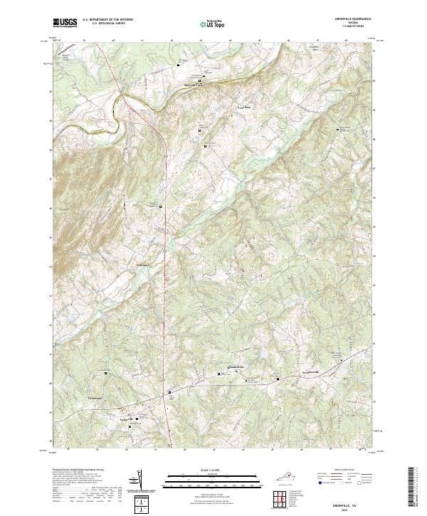
2022 Map of Unionville
USGS Topo · Published 2022About this map
The Rapidan River forms the natural boundary between Culpeper and Orange counties, anchoring a landscape defined by historic agricultural crossroads and family legacies. This part of Virginia is heavily marked by its early settlement patterns, visible in the high density of small family and church burial grounds such as the Stringfellow Homestead Cem and the Lee Family Cem. The village of Unionville serves as a southern hub, while the northern reaches near Raccoon Ford and True Blue trace the winding river corridor.
Find a feature on this map
113 named features on this map. Tap any name to fly to it.
Don’t see what you’re looking for? This feature index may not catch every label — zoom into the map to look around manually.
Map Details
Editions of this 2022 Unionville Map
This is the sole edition of this map. No revisions or reprints were ever made.
Other maps of this area

1887 · Spottsylvania
USGS Topo · 1:125,000

1892 · Spottsylvania
USGS Topo · 1:125,000

1892 · Gordonsville
USGS Topo · 1:125,000

1942 · Lahore
USGS Topo · 1:31,680

1942 · Belmont
USGS Topo · 1:31,680

1943 · Germanna Bridge
USGS Topo · 1:24,000

1943 · Culpeper
USGS Topo · 1:24,000

1943 · Mine Run
USGS Topo · 1:24,000

1943 · Unionville
USGS Topo · 1:24,000
1944 · Culpeper
USGS Topo · 1:31,680