
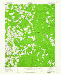
1942 Map of Belmont
USGS Topo · Published 1942About this map
Panaminas Inc (Valzinco Mine) stands as a primary industrial landmark in this 1942 survey, highlighting the mineral extraction history of the Piedmont. The landscape across the Orange County and Spotsylvania County line is defined by a network of rural crossroads and community hubs. Small settlements such as Richards Shop, Paytes, and Logan are connected by a web of unimproved and secondary roads, while the local social fabric is traced through landmarks like Craigs Church, Oliver Church, and Mt Herman Church. Near the southern edge, Belmont and Stubbs anchor the topography, which is drained by the North Fork and Robertson Run. This wartime-era documentation captures a specific moment in the agrarian and industrial development of the region, before modern suburban expansion altered the layout of these traditional Virginia communities.
Find a feature on this map
21 named features on this map. Tap any name to fly to it.
Don’t see what you’re looking for? This feature index may not catch every label — zoom into the map to look around manually.
Map Details
Editions of this 1942 Belmont Map
2 editions found
Other maps of this area

1887 · Spottsylvania
USGS Topo · 1:125,000

1892 · Spottsylvania
USGS Topo · 1:125,000

1942 · Mineral
USGS Topo · 1:31,680

1942 · Lahore
USGS Topo · 1:31,680

1942 · Partlow
USGS Topo · 1:31,680

1942 · Contrary Creek
USGS Topo · 1:31,680

1942 · Brokenburg
USGS Topo · 1:31,680

1943 · Chancellorsville
USGS Topo · 1:24,000

1943 · Mine Run
USGS Topo · 1:24,000

1943 · Unionville
USGS Topo · 1:24,000