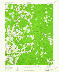
1942 Map of Belmont
USGS Topo · Published 1961About this map
Orange and Spotsylvania counties are divided by a meandering boundary through this heavily wooded landscape, surveyed in the early 1940s. The region is defined by small crossroads settlements and rural hubs like Belmont, Paytes, and Stubbs, connected by a network of unimproved dirt and light-duty roads. These early thoroughfares follow the natural ridges between significant watercourses such as the North Fork Anna River and Robertson Run.
Find a feature on this map
22 named features on this map. Tap any name to fly to it.
Don’t see what you’re looking for? This feature index may not catch every label — zoom into the map to look around manually.
Map Details
Editions of this 1942 Belmont Map
2 editions found
Other maps of this area

1887 · Spottsylvania
USGS Topo · 1:125,000

1892 · Spottsylvania
USGS Topo · 1:125,000

1942 · Mineral
USGS Topo · 1:31,680

1942 · Lahore
USGS Topo · 1:31,680

1942 · Partlow
USGS Topo · 1:31,680

1942 · Belmont
USGS Topo · 1:31,680

1942 · Contrary Creek
USGS Topo · 1:31,680

1942 · Brokenburg
USGS Topo · 1:31,680

1943 · Chancellorsville
USGS Topo · 1:24,000

1943 · Mine Run
USGS Topo · 1:24,000