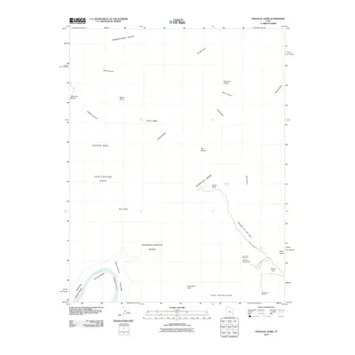
2010 Map of Upheaval Dome
USGS Topo · Published 2010About this map
Upheaval Dome dominates this 2010 USGS quadrangle, revealing the complex geology and high desert terrain of Canyonlands National Park. This survey details the dramatic drop from the Island in the Sky plateau down to the White Rim and the Green River corridor. The map highlights numerous named geological spires and formations, including Zeus and Moses, Whale Rock, and Candlestick Tower, which define the horizon of this protected landscape. To the west, the river creates large meanders at Valentine Bottom and Unknown Bottom, separated from the higher mesas by steep-walled features like Upheaval Canyon and Stillwater Canyon. Cultural development is limited to primitive recreational sites like Willow Flat Campground and the Upheaval Dome Rd, providing a detailed look at the trailheads and viewpoints that provide access to Syncline Valley and the Holeman Spring Basin.
Find a feature on this map
35 named features on this map. Tap any name to fly to it.
Don’t see what you’re looking for? This feature index may not catch every label — zoom into the map to look around manually.
Map Details
Editions of this 2010 Upheaval Dome Map
This is the sole edition of this map. No revisions or reprints were ever made.
Other maps of this area

1885 · San Rafael
USGS Topo · 1:250,000

1885 · La Sal
USGS Topo · 1:250,000

1951 · The Knoll
USGS Topo · 1:62,500

1951 · Upheaval Dome
USGS Topo · 1:62,500

1952 · Tidwell 4 SE
USGS Topo · 1:24,000

1952 · Carlisle 2 SE
USGS Topo · 1:24,000

1952 · Carlisle 2 NW
USGS Topo · 1:24,000

1952 · Moab 3 SE
USGS Topo · 1:24,000

1952 · Carlisle 2 NE
USGS Topo · 1:24,000

1952 · Carlisle 2 SW
USGS Topo · 1:24,000