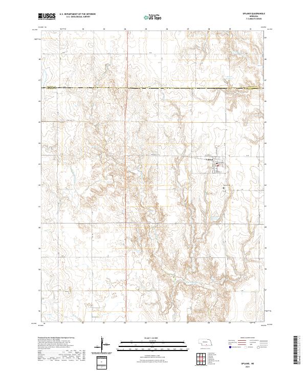
2021 Map of Upland
USGS Topo · Published 2021About this map
Upland occupies the high ground of the Nebraska plains, positioned along the county line between Kearney Co and Franklin Co. This rural landscape is defined by the headwaters of W Br Thompson Cr and the Little Blue River, which carve subtle drainage patterns across the agricultural sections. The village of Upland is structured around a traditional grid including Belfield St and Midland St, with the Upland Cem located just to the south. Small-scale water management is evident through features like Olson Reservoir and Bertrand Reservoir, which support the region's farming economy. The map illustrates a strict section-line road network, such as A Rd and V Rd, characteristic of the Great Plains' development during the twentieth century.
Find a feature on this map
26 named features on this map. Tap any name to fly to it.
Don’t see what you’re looking for? This feature index may not catch every label — zoom into the map to look around manually.
Map Details
Editions of this 2021 Upland Map
This is the sole edition of this map. No revisions or reprints were ever made.
Other maps of this area

1896 · Holdrege
USGS Topo · 1:125,000

1897 · Red Cloud
USGS Topo · 1:125,000

1955 · Grand Island
USGS Topo · 1:250,000

1957 · Grand Island
USGS Topo · 1:250,000

1958 · Grand Island
USGS Topo · 1:250,000

1969 · Upland
USGS Topo · 1:24,000

1969 · Upland SE
USGS Topo · 1:24,000
1969 · Norman
USGS Topo · 1:24,000
1969 · Minden South
USGS Topo · 1:24,000
1970 · Axtell East
USGS Topo · 1:24,000