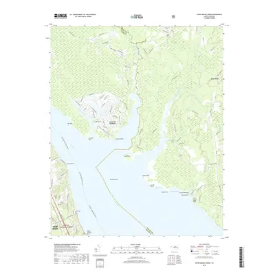
2019 Map of Upper Broad Creek
USGS Topo · Published 2019About this map
Upper Broad Creek and the wide expanse of the Neuse River define this coastal landscape where Craven and Pamlico counties meet. The planned residential development of Fairfield Harbour stands in contrast to the surrounding wetlands and timberlands, its intricate canal system and street network including Harbourside Dr and Marina Dr reaching toward the river. To the south, the boundary of the Croatan National Forest begins, while the eastern shore is marked by small waterfront settlements such as Kennel Beach.
Find a feature on this map
92 named features on this map. Tap any name to fly to it.
Don’t see what you’re looking for? This feature index may not catch every label — zoom into the map to look around manually.
Map Details
Editions of this 2019 Upper Broad Creek Map
This is the sole edition of this map. No revisions or reprints were ever made.
Other maps of this area

1901 · New Bern
USGS Topo · 1:62,500

1903 · New Bern
USGS Topo · 1:62,500

1942 · Maysville
USGS Topo · 1:62,500

1948 · Maysville
USGS Topo · 1:62,500

1949 · Havelock
USGS Topo · 1:24,000

1949 · Cherry Point
USGS Topo · 1:24,000

1950 · New Bern
USGS Topo · 1:24,000

1950 · Upper Broad Creek
USGS Topo · 1:24,000

1950 · Arapahoe
USGS Topo · 1:24,000

1951 · Arapahoe
USGS Topo · 1:24,000