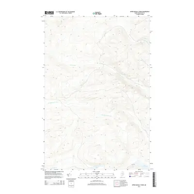
2014 Map of Upper McNally Pond
USGS Topo · Published 2014About this map
Little Musquacook Stream and its numerous tributaries dominate this 2014 survey of the Maine north woods in Aroostook County. This area represents the dense hydrographic network of the T12 R10 WELS township, where the landscape is defined by drainage systems like Big Brook and the unique naming conventions of the logging era, such as Twentyfive Mile Brook and Reality Rd. While the interior remains largely inaccessible by major thoroughfares, the network of forks—including Left Fork Farrar Brook and Right Fork Farrar Brook—highlights the complex hydrology of the region. Small water bodies like Squirrel Pond and the northern tip of Upper McNally Pond serve as central landmarks for navigators and naturalists in a territory characterized by significant elevation changes and deep forest cover.
Find a feature on this map
11 named features on this map. Tap any name to fly to it.
Don’t see what you’re looking for? This feature index may not catch every label — zoom into the map to look around manually.
Map Details
Editions of this 2014 Upper McNally Pond Map
This is the sole edition of this map. No revisions or reprints were ever made.
Other maps of this area

1931 · Fish River Lake
USGS Topo · 1:48,000

1931 · Mooseleuk Lake
USGS Topo · 1:48,000

1932 · Musquacook Lakes
USGS Topo · 1:48,000

1932 · Allagash Falls
USGS Topo · 1:48,000

1935 · Musquacook Lakes
USGS Topo · 1:62,500

1935 · Fish River Lake
USGS Topo · 1:62,500

1935 · Mooseleuk Lake
USGS Topo · 1:62,500

1935 · Allagash Falls
USGS Topo · 1:62,500

1954 · Presque Isle
USGS Topo · 1:250,000

1956 · Allagash Falls
USGS Topo · 1:50,000