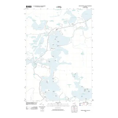
2010 Map of Upper Saranac Lake
USGS Topo · Published 2010About this map
Saranac Inn and Wawbeek anchor this study of the central Adirondack waterscape, where complex glacial hydrology created a dense network of connected ponds and larger lake basins. The presence of the Adirondack Fish Hatchery near Little Clear Pond underscores the long-standing importance of local fisheries management within the Adirondack Park. Ancient portage routes are preserved in modern place names such as Bartletts Carry, connecting Upper Saranac Lake to nearby waters. The landscape is defined by dozens of distinct water bodies, including the secluded Hoel Pond and the branching Fish Creek Ponds. Landforms like Markham Point and numerous named islands—including Eagle Island, Buck Island, and Deer Island—detail a shoreline shaped by recreational history and conservation efforts in the early 21st century.
Find a feature on this map
79 named features on this map. Tap any name to fly to it.
Don’t see what you’re looking for? This feature index may not catch every label — zoom into the map to look around manually.
Map Details
Editions of this 2010 Upper Saranac Lake Map
This is the sole edition of this map. No revisions or reprints were ever made.
Other maps of this area

1902 · Saranac
USGS Topo · 1:62,500

1904 · Saranac
USGS Topo · 1:62,500

1904 · Santanoni
USGS Topo · 1:62,500

1904 · Long Lake
USGS Topo · 1:62,500

1905 · Saint Regis
USGS Topo · 1:62,500

1948 · Ogdensburg
USGS Topo · 1:250,000

1951 · Ogdensburg
USGS Topo · 1:250,000

1953 · Ogdensburg
USGS Topo · 1:250,000

1953 · Santanoni
USGS Topo · 1:62,500

1955 · Long Lake
USGS Topo · 1:62,500