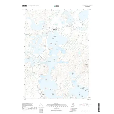
2019 Map of Upper Saranac Lake
USGS Topo · Published 2019About this map
Upper Saranac Lake dominates this northern Adirondack landscape, serving as a central hub for a complex network of waterways including Fish Creek Bay, Little Square Bay, and Gilpin Bay. The historic settlement of Saranac Inn anchors the north end of the lake, while Wawbeek sits to the south, connected by winding routes like Co Hwy 46 and Adirondack Park roads. The area is defined by its glacial hydrology, featuring dozens of distinct water bodies such as Hoel Pond, Follensby Clear Pond, and Lake Clear. Within the Adirondack Park Preserve, numerous named islands like Eagle Island, Buck Island, and Goose Island dot the open water, while the shoreline is marked by family-named landmarks including Markham Point and Bull Point.
Find a feature on this map
94 named features on this map. Tap any name to fly to it.
Don’t see what you’re looking for? This feature index may not catch every label — zoom into the map to look around manually.
Map Details
Editions of this 2019 Upper Saranac Lake Map
This is the sole edition of this map. No revisions or reprints were ever made.
Other maps of this area

1902 · Saranac
USGS Topo · 1:62,500

1904 · Saranac
USGS Topo · 1:62,500

1904 · Santanoni
USGS Topo · 1:62,500

1904 · Long Lake
USGS Topo · 1:62,500

1905 · Saint Regis
USGS Topo · 1:62,500

1948 · Ogdensburg
USGS Topo · 1:250,000

1951 · Ogdensburg
USGS Topo · 1:250,000

1953 · Ogdensburg
USGS Topo · 1:250,000

1953 · Santanoni
USGS Topo · 1:62,500

1955 · Long Lake
USGS Topo · 1:62,500