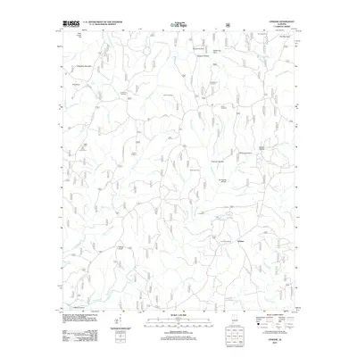
2011 Map of Upshaw
USGS Topo · Published 2011About this map
Upshaw sits at the heart of this Winston County landscape, where the plateau is deeply incised by a dense network of creek branches and hollows. The area's social history is recorded through its many family and community burial grounds, including the Corinth Cemetery, Asherbraner Cemetery, and Friendship Cemetery, which are scattered among the ridges. The terrain is defined by prominent elevations such as Hickory Knob, Dillashaw Mountain, and High House Hill, while the drainage system flows through named corridors like Capsey Canyon and Sheats Hollow. This 2011 survey illustrates a rural environment shaped by the drainage patterns of Turkey Creek, Indian Creek, and West Flint Creek. Modern recreational use is evidenced by the Owl Creek Horse Camp, positioned near the headwaters of Owl Creek. The map provides a detailed view of the county road network, such as Co RD 41, which connects these dispersed settlements and landmarks across the rugged topography.
Find a feature on this map
52 named features on this map. Tap any name to fly to it.
Don’t see what you’re looking for? This feature index may not catch every label — zoom into the map to look around manually.
Map Details
Editions of this 2011 Upshaw Map
This is the sole edition of this map. No revisions or reprints were ever made.
Other maps of this area

1935 · Moulton
USGS Topo · 1:24,000

1935 · Upshaw
USGS Topo · 1:24,000

1935 · Danville
USGS Topo · 1:48,000

1935 · Oakville
USGS Topo · 1:24,000

1936 · Mc Kendry
USGS Topo · 1:24,000

1936 · Moulton
USGS Topo · 1:48,000

1936 · Stroups Crossroads
USGS Topo · 1:24,000

1938 · Danville
USGS Topo · 1:62,500

1940 · Mt Hope
USGS Topo · 1:62,500

1956 · Gadsden
USGS Topo · 1:250,000