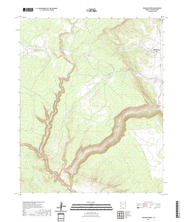
2021 Map of Uranium Spring
USGS Topo · Published 2021About this map
Oak Springs and the surrounding high desert of the Defiance Plateau define this corner of Apache County. The landscape is marked by deep drainage systems and essential water sources, including the namesake Uranium Spring and Campus Tank. These water points were critical for livestock and settlement in an arid environment where topography dictates movement. The deep incision of Black Creek carves through the southern half of the map, creating the distinct Oak Spring Valley. Infrastructure is concentrated along a few key corridors, notably Indian Rte 12 and the route past the former site indicated by Pine Springs School Rd. This 2021 update documents the modern land divisions and access routes within the Navajo Nation, showing how historical pathways have evolved into the current road network serving remote homesteads and grazing lands.
Find a feature on this map
16 named features on this map. Tap any name to fly to it.
Don’t see what you’re looking for? This feature index may not catch every label — zoom into the map to look around manually.
Map Details
Editions of this 2021 Uranium Spring Map
This is the sole edition of this map. No revisions or reprints were ever made.
Other maps of this area

1886 · Fort Defiance
USGS Topo · 1:250,000

1892 · Fort Defiance
USGS Topo · 1:250,000

1954 · Gallup
USGS Topo · 1:250,000

1958 · Gallup
USGS Topo · 1:250,000

1959 · Gallup
USGS Topo · 1:250,000

1962 · Gallup
USGS Topo · 1:250,000

1967 · Gallup
USGS Topo · 1:250,000

1971 · Burntwater Wash
USGS Topo · 1:24,000
1971 · Joe Woody Well
USGS Topo · 1:24,000
1971 · Hunters Point
USGS Topo · 1:24,000